Aug. 20, 1964
To botanize the extreme western end of the Siskiyous, or to explore them for future botanical incursions at appropriate seasons, the best approach is from the ocean side, up the various rivers that penetrate deeply into the famously rugged Curry County of Oregon and California’s Del Norte County – the Rogue, Pistol River; the Chetco, Winchuck and Smith Rivers. From my Packer’s Gulch headquarters in the Illinois Valley, I have made circuitous forays up all of these, so far making no startling botanical discoveries, but having a wonderful time trying.
My latest assault on the jumbled mountain wilderness of Curry County took me over the longest, crookedness, and most interesting route of all. I took to the mountains from a point near the top of Hayes Hill, west on the Onion Mountain Lookout Road and northerly to the Rogue. This stretch of mountain road, from Hayes Hill to its intersection with the Rogue River Highway not far above Galice, a distance of twenty-five or thirty miles, is in excellent condition. Grades are long and winding, but moderate. A number of points of interest are met along the way. A sign points the way into Secret Valley, and if you are curious, and have some time to spare, you might search for the secret hidden there. The road winds down into Brigg’s Valley, where there’s a pleasant place by the stream to eat your snack and, perchance, open a can of cold bevo. Farther in is the lovely Big Tree Forest Camp. A short walk back through the shady woods here, on a well-kept trail, brings you to the tallest known Ponderosa pine.
Some distance below Galice, a small community on the Rogue known best to her readers as the home of Mary Lou Wood, my way led across the Rogue and away into the north and west. For more than fifty miles the tortuous up-and-down road winds through the rough mountainous country of Coos and Curry counties, finally bringing you – if you watch your road signs – again to the Rogue, at Agness. I recrossed the Rogue here, crossed the mouth of the Illinois a short distance below Agness on a low dry-weather bridge (a new high bridge is under construction here across the Illinois), and continued down the south side of the Rogue to Gold Beach, twenty-five or thirty miles west.
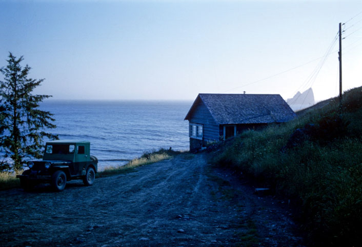
Between Gold Beach and Pistol River to the south, on the ocean shore a hundred yards or so below the highway, perched on a bluff fifty feet above a cozy little beach, is a cozy little house where I’d spent some previous pleasant hours. It is the home of Ben and Lola Gardner, a pair of enthusiastic plant-hound friends of mine. They were not at home when I reached their place, but the latch string was out and I made myself at home. I suspected they were away for the weekend and was comfortably snuggled down for a quiet secluded evening when here they came, barging in on me like an ocean gale. Before I could catch my breath, Lola dragged out a plastic bag of wild plants they had collected over near Ashland and Dutchman’s Peaks. The bag held one little nugget for me – the little Dwarf Sage, found in the Siskiyous only in their eastern end.
Next day we went up the Winchuck botanizing, and picnicking with some friends at the Winchuck Forest Camp. We found ghost pipes and pinesaps growing in the campgrounds. Scarlet monkey-flower was just nodding farewell along the stream bank; penstemon and nightshade, too, were just about through blooming and were setting about their business of setting seed for a new generation. The wildflower season at low altitudes is just about done.

The following day, Sunday, held a real thriller for me. Ben took me to gold Beach where a friend of his, Rich Buffington, a top-flight pilot, took us up in his twin-engine Piper for a flight over the mountains. We looked over the Craggies (which I intended to invade on foot the next day), flew over Babyfoot lake, Rough and Ready Lake, circled over the tunnel area, on over Young’s Valley, Raspberry Lake, circled low around the top of Preston Peak and over the Devil’s Punchbowl. Then down Smith River Canyon to Crescent City, where Rich made a couple of practice runs in to the Crescent City airport through the dense fog, then up the coast to Gold Beach.
For a long time I’ve been wanting to fly over my mountains, to look down on them and photograph them from above. And I couldn’t have found a more accommodating pilot. When I wanted a picture, he would circle to get the sun in the best position, and then drop a wing, so I could get a clear shot. That flight was even more fun than glissading down the side of Mt. Shasta.
That same evening I left Gardner’s and drove up the Chetco about twenty miles and up into the mountains on the High Prairie road in the vicinity of the Craggies. I camped up there two nights, hiked nine hours one day on the high rough Craggies ridge, over the top of Green Craggy and on toward the big one. But I was finally stopped by an impenetrable tangle of brush. Next time my approach will be from the north side, the way the Leaches went in when they discovered Kalmiopsis in the Craggies.
Before leaving the Chetco area I drove up to Vulcan Peak and hiked in to Vulcan Lake, a pretty blue lake high on the side of Vulcan Peak that I’ve been wanting to photograph for my lake collection.
I spent one more night at Gardner’s, returning home by way of Smith River, Van Deventers and the Redwood Highway. My trip lasted six days, and I can’t recall ever having spent a more enjoyable week. It was a much-needed and well-merited vacation, what with the grueling work I’ve been doing these past 6 months or so – climbing mountains, hiking the forest trails, and scientifically sniffing countless wildflowers.